|
This Webpage Title:
Hong Kong - The Island and towns,
The Outlying Islands,
Tsim Sha Tsui,
China - Hong Kong - Macau
There are 234 outlying islands, many of them little more than uninhabited rocks.
However, Cheung Chau (2.5 sq km/1 sq mi) has 22,000 residents and is fast developing into a mini Honolulu, although there is no motorised traffic and no surf!

Lantau, the largest of the islands (142 sq km/55 sq mi) has a population of 45,000, a 933m (3060ft) peak, and a 70km (43mi) walking trail, but has avoided many of the development excesses of other islands.
Lantau is home to several important monasteries, including Po Lin Monastery with its enormous bronze Buddha.
Thanks to the newish airport development, Lantau is now connected by bridge to the mainland.
Other main inhabited islands are: Peng Chau, Poi Toi, Lamma Island and Tung Lung Chau.
Lantau Island
Lantau Island (big island mountain) is the biggest of the outlying islands, actually, it is even bigger than Hong Kong Island itself. It has a very attractive mountain scenery (the highest mountain is Lantau Peak with 934 meters) and an impressive rocky coastline with pretty white beaches. Most visitors come there in order to visit the famous Po Lin Monastery, but Lantau Island is also ideal for hiking tours.
Two mountains lie at the heart of Lantau. The higher of them, 934-metre Lantau Peak, is the second highest mountain in Hong Kong; its upper reaches form a distinctive, sharp cone, in contrast to the more rounded outline of neighbouring Sunset Peak.
Tai O, also known as the "Oriental Venice" was the largest settlement on Lantau Island, though it is in decline now. The water combining with the stilt houses on the waterfront at dusk gives visitors a touch of romance, forming the most unforgettable scene in Tai O.
With wild countryside, monasteries, old fishing villages and seriously secluded beaches, Lantau Island, for those who are tired of the noise and polluted city life, is definitely a place to visit or even to live with. There are a lot of outdoor activities that people can do such as hiking, mountain biking, camping, fishing and etc.
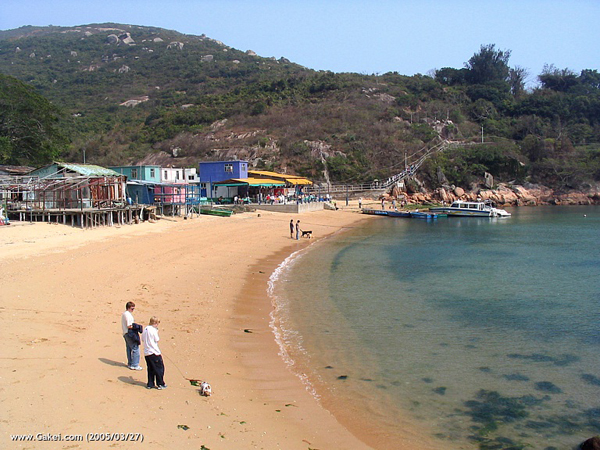
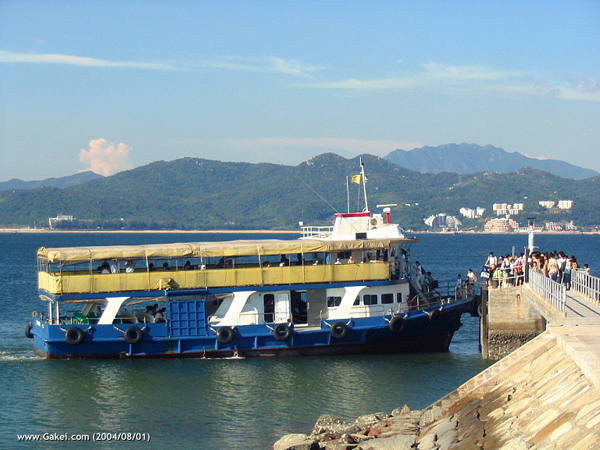
The ferries from Central District arrive at Silvermine Bay (Mui Wo), Lantau's main township. The trip takes about an hour and leads you along lots of tiny little islands to Lantau. Silvermine Bay is a little town with a beach and lots of little restaurants; most of them specialise in seafood.
The bus terminal is right in front of the ferry pier; there are several buses per day to Po Lin Monastery. The ride is admittedly not very comfortable (the roads are narrow, steep, and run in serpentines) but you get breathtaking views of the sea and the mountains.
Po Lin Monastery is located at 450 meters altitude on the Ngong Ping Plateau. Po Lin is not a historical site; it was opened in 1970. The main hall has two floors and is covered with an elaborately decorated roof and hosts three big, golden Buddha statues.
The main attraction of Po Lin, however, is the 34 m high giant Buddha statue outside. It weighs 250 tons and is said to be the biggest Buddha statue in Asia (quite believable).
You have to climb a lot of stairs to reach the platform but it is worth the effort because you enjoy a wonderful view of the Lantau, of the little islands that surround it, and of the blue South China Sea.
Also located on Ngong Ping Plateau is a tea plantation; the only one in the territory of Hong Kong. You can try its products in the associated tea garden.
Lantau Island has a very low density population, with 45,000 people living there, compared to 1.4 million on Hong Kong Island.
Settlements are scattered all over the island and each has its own distinctive characteristic. The completion of the Hong Kong International Airport in 1998 has irrevocably changed northern Lantau. The once quiet village of Tung Chung is now a mass of high-rise housing estates next to the airport.
Lantau Island, together with Tuen Mun were among the first European trading settlements in the Pearl River area, established by Portuguese traders in the 1510s.
The Portuguese abandoned these settlements around 1517, following defeat against Chinese troops (see Fernao Pires de Andrade ).
Later, the island became an important trading post for the British, long before they showed an interest for Hong Kong Island.
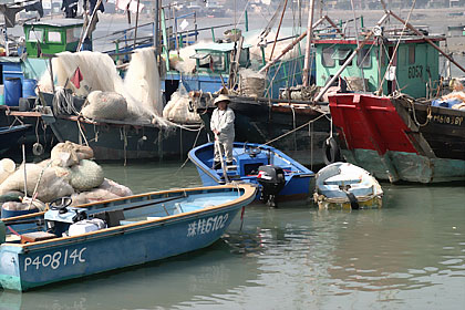
Silver was mined at Mui Wo (Silvermine Bay) until the 19th century.
Lantau Island Photo Gallery Linked Here
Lamma Island

Also known as Po Liu Chau, is the third largest island in Hong Kong
Lamma was named after the shape of the island which looks like the limb of a tree, or the letter Y (corresponding to the Chinese character of "ma"), and Lam means "south".
The northern village is called Yung Shue Wan (Banyan Tree Bay) and the eastern village Sok Kwu Wan.
The southern part of Lamma Island has minimal population. Sham Wan, an important breeding site for sea turtles, is located there. This bay is also the site of an important Bronze Age settlement which was unearthed by archaeologists in the 1970s. It yielded evidence of people living on Lamma during the " Middle Neolithic " phase (approximately 3800-3000 BC).
Lamma is a pretty little island west of Hong Kong Island, very peaceful and tranquil, with lovely hills and forests, only separated by the narrow East Lamma Channel from Aberdeen.
There are no historical buildings or important temples on the island; it is mainly interesting for people who enjoy beautiful natural scenery.
There is a regular ferry services several times a day to and from Yung Shue Wan and Sok Wo Wan, the two villages on Lamma, and Central District on Hongkong Island (get a schedule at the Central District Outlying Islands pier , so that you can plan your return).
There is a path from Yung Shue Wan over the hills and through the valleys to Sok Wo Wan (there are no cars or buses on the island). (See map of Lamma )
If you have a full day you can start at either one and walk over the hills to the other village (you need between one and a half two hours for this).
There are good, inexpensive seafood restaurants both in Sok Wo Wan and Yung Shue Wan, where you can enjoy a good meal before you take the ferry back to Hongkong Island.
Lamma Island Photo Gallery Linked Here
Peng Chau

Peng Chau (literally, flat island) is located 7 km west of Hong Kong Island, with an area of approximately 1 sq. km and a population of about 7,000.
The Island offers a complete contrast to the main urban area of Hong Kong, as 70% of its land and 60% of the coastlines are unspoiled and rural in nature.
Peng Chau has no industries, no motor vehicles and traffic jams. There, people live a simple but enriched lifestyle in harmony with nature.
At traditional Chinese festivals, residents get together to celebrate with enthusiasm and respect for the community, tradition and cultural heritage.
Although no official history of Peng Chau was recorded, we still can trace the pieces back from some books, indigenous people's memories and archaeological findings.
It was once a prosperous industrial island. In the late Ching Dynasty, as many as eleven lime kiln factories there employed hundreds of workers. Peng Chau was also an important fishing port.
By early 1900s, the Island was the largest base for lime kiln operations in Hong Kong. Lime, made of corals and shells, were for building and agricultural uses.
Later, cement works drove out all village lime kiln enterprises. In early 1940s, the "Great China Matches Factory" employed about 2,000 workers.
In the 1960s, other industries sprouted including woodworks, leather, rattan, handicraft, porcelain painting, industrial iron tubes, textile, boat building and many other family style factories.
In the 1980s, with the downfall of local industries came the development of the real estates.
Many city-dwellers moved to Peng Chau, attracted by reasonable rents, low crime rate, clean air and an overall peaceful atmosphere. Nevertheless, with high ferry fares and the opening of Tung Chung Tunnel in the nearby Discovery Bay, Peng Chau residential property business has long been saturated and is no long sustainable.
Still, Peng Chau's natural charm is appealing to the locals and many Hong Kong residents.
At the hilltop is a beautiful 360-degree sea view of the whole Hong Kong. The Island is rich in bio-diversity, including native plants, insects, birds, corals and marine invertebrates such as different species of mollusks and crustaceans. Sometimes, you may spot the Chinese white dolphins in nearby water.
Link to Peng Chau Island Photo Gallery
Tung Lung Chau (Nam Tong Island)
Tung Lung Chau floats off the southern tip of the Clear Water Bay peninsular in eastern New Territories. Also known as Nam Tong Island, the biggest attraction here is the Buddhist Hall Fort constructed almost 300 years ago but was recently refurbished.
Getting to the port is simple; just follow the path from the hamlet at the ferry pier over the rolling, open landscape of northern Tung Lung.
The northern shore of the island features famous rock carvings on the cliffs that depict the daily lives of people from the area over decades ago.
It is a good place to enjoy the sea view, with waves rushing to the shore and for taking hikes up the cliffs and hills. To get to Tung Lung, there are no available ferries but the kaido boats from Shau Kei Wan on Hong Kong Island operate on most weekends.
Tung Lung Chau is a more or less circular island, about 2km. in diameter, east of Hong Kong island and just off the tip of Clearwater Bay Peninsula.
It is largely bare of trees with a 232m. peak in the middle of the of the island. The island is now uninhabited apart from a few families who cater for day trippers. This walk is a short out-and-back stroll from the ferry pier to the fort at the north-west tip of the island.
As forts go, this one is pretty unimpressive, but it is located on an interesting headland with lots of rock-clambering opportunities for kids.
Po Toi Island
Po Toi Island, resided by only a handful of people, is comprised of a group of islands located at the southernmost area of the territory of Hong Kong, southeast of Stanley on Hong Kong Island. The place is known for a large rock resembling a river snail, and under that rock is a den with rock carvings shaped by wind and rain. Po Toi is full of interesting and peculiar sights that often catch the attention of curious visitors. The Deserted House of Mo's Family and the nearby Coffin Rock are among the many attractions.
The south of the island features many strange rock formations, including the Calligraphy by Ghosts, Buddha's Hands Rocks, and Monk Rocks.
At the pier, there is an abundance of open-air restaurants that serves extremely delicious seafood. Most Hong Kong residents hire a junk or boat to Po Toi on weekends. The kaido, small boats that act as water-taxis, are available from Aberdeen and Stanley on Sundays and public holidays for about HK$40 per person round-trip.
Ping Chau
One of the territory's most remote islands is Ping Chau, which is situated at Mirs Bay, northeast of Kowloon. Previously an island with a population of 3,000, most of the islanders have moved to urban areas and only return on weekends and public holidays to run their restaurants or hotel businesses.
The island is excellent for picnics and most city dwellers hound the grounds during holidays to enjoy the silence surrounded by beautiful white-sand beaches.
Ping Chau is made up of different shapes and colors. There are plenty of natural attractions such as caves, rock formations, and waterfalls with flowery names given by locals.
Visitors will also be able to spot some old-fashioned stone houses with courtyards and winding passages. Village houses for rent are plentiful; even small bed-and-breakfast joints can be found.
The way to Ping Chau is aboard the ferry from Ma Liu Shui, near the university railway station in the New Territories.
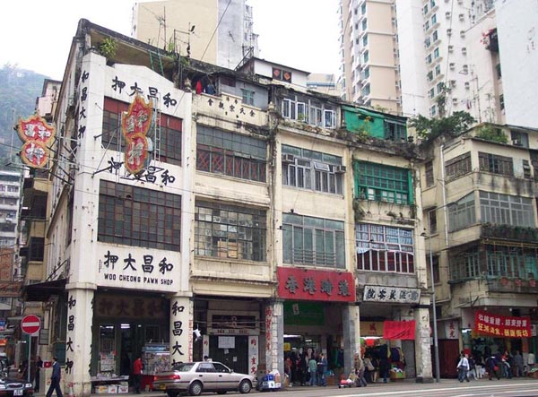
Apart from the Islands, there is the main island which incorporates Hong Kong's business district and residential area. 'The Island' has many townships, as seen from the map:
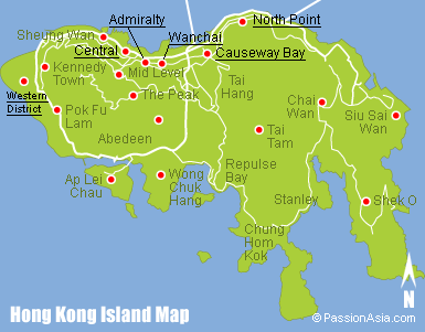
Wanchai is the business district
As well as residential
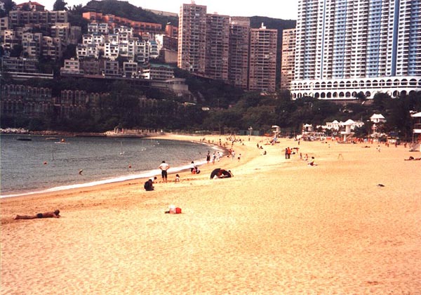
Repulse Bay is a beach within a city

Causeway Bay 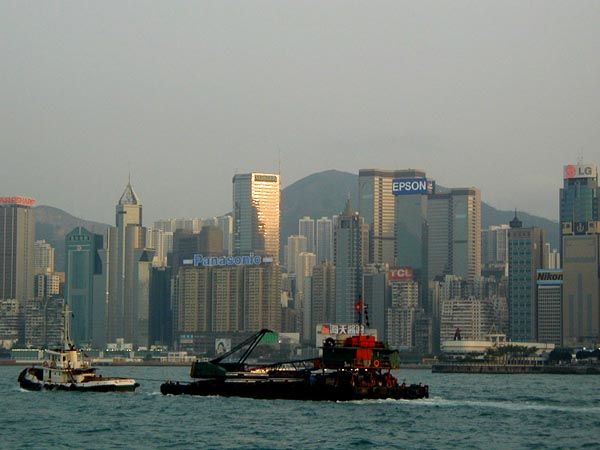
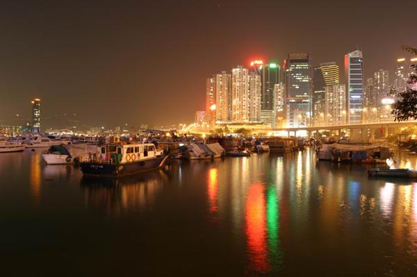
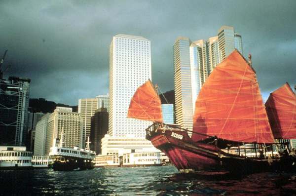
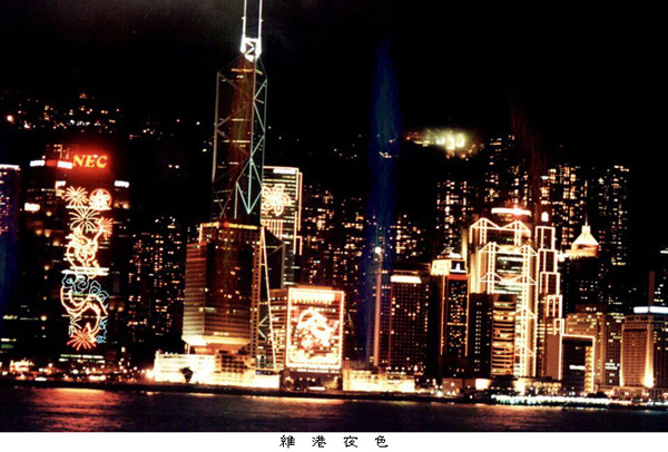
Victoria Harbour
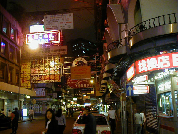
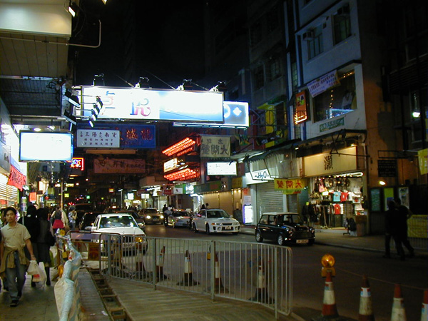
Tsim Sha Tsui

|