|
This Webpage Title:
China -
China - Hong Kong - Macau
Macau is located on the Southeast coast of China to the west of the Pearl River Delta. Bordering on Guangdong Province. It's area is 23.8square kilometers and it's climate is warm and humid with a fairly wide variation in temperature over the year.
From June to September, the temperature can rise to over 30 degrees while it can drop to below 10 degrees from November to February. The average temperature rarely drops below 14oC. Mac au 's weather is also influenced by tropical cyclones from the South Pacific Ocean during the typhoon season.
Macau may be firmly back in China's orbit, but the Portuguese patina on this Sino-Lusitanian Las Vegas makes it a most unusual Asian destination. It has always been overshadowed by its glitzy near-neighbour Hong Kong - which is precisely why it's so attractive.
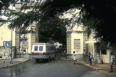
Macau's pleasures are relaxed and laid back, architectural and atmospheric: narrow cobbled alleys, grand baroque churches, balconied colonial mansions, open plazas and Mediterranean-style cafes filled with palm-readers, caged birds and pipe-smokers.
These days Macau is wooing commerce and tourism like never before, and plans are afoot for all kinds of family-oriented shopping malls, theme parks, towers and bridges, building on the enclave's attraction as a gambling haven. So get yourself to Macau before its unique Latin-Sino flavour is diluted by a heavy dose of development and the Guangdong throngs.
Area: 23.8 sq km (9 sq mi)
Population: 438,000
People: 95% Chinese, less than 2% Portuguese
Province: Macau Special Administrative Region
Main language: Cantonese, Portuguese, English
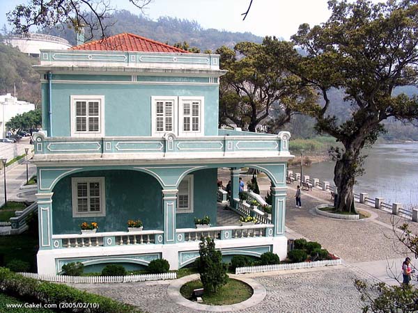
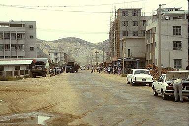

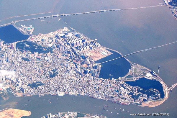
Macau is made up of two islands and a compact peninsula dangling off the Guangdong mainland into the South China Sea. Hong Kong is just a 65km (40mi) swim away across the Pearl River delta, and the Guangdong capital, Guangzhou (aka Canton), is on the Pearl River 150km (90mi) or so to the north. Macau is tiny: all up, the mainland peninsula plus its two southerly islands (Taipa and Coloane) add up to a measly 23.5 sq km (9 sq mi) - Hong Kong Island alone measures more than three times its size. Development is gradually overtaking the peninsula and Taipa, but Coloane remains largely unspoilt. Macau international airport is on Taipa's east coast. Airport buses travel between the airport and major hotels on Taipa and the Macau Peninsula (every 15 minutes, US$0.80), and taxis meet all incoming flights (US$5).

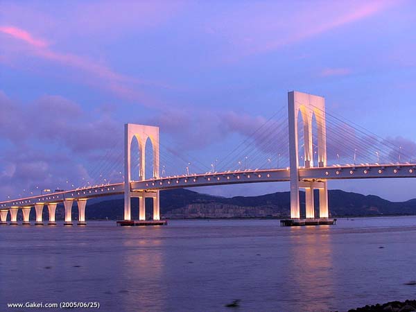
Most of Macau's attractions are clustered around the peninsula's centre - it's a hilly but rewarding walk from church to fort and back again. Land reclamation at the foot of the peninsula has increased Macau's acreage by 20% and created the two artificial Nam Van Lakes. Taipa Island is linked to the peninsula by two bridges, and a causeway links Taipa with Coloane - but watch this space, as there are ambitious plans to merge the two islands courtesy of a mega-reclamation business and residential project called Cotai City. The new Lotus Flower Bridge connects Taipa to the Chinese mainland and meets the Guangzhou-Zhuhai highway.

Macau's hotels run the gamut from roach motels to luxury pads, with a sprawling mass of mid-range options in between. For cheapies head to the western side of the peninsula near the Floating Casino; top-end places are clustered near the centre of town and at the foot of the peninsula. Both islands have a smattering of five-star resorts, and there's a hostel on Coloane. Keep in mind that accommodation is both hard to find and expensive on weekends and public holidays. The evening street markets are good for seafood, and there's a wealth of peninsular and Taipa cafes and restaurants offering Cantonese, Macanese, African and Brazilian specialities.
Attractions
A-Ma Temple
Called Ma Kok Miu in Cantonese, this striking temple is dedicated to the goddess A-Ma, better known as Tin Hau. There was a temple here when the Portuguese arrived, although the present structure may only date from the 17th century. At the main entrance is a large boulder with an engraved lorcha (traditional sailing vessel of the South China Sea).
Guia Fort
Overlooking the Lou Lim Ioc Gardens, the Guia Fort is perched on the peninsula's highest point and topped by a chapel and the Chinese coast's oldest lighthouse (1865). It's a long and perspiring walk to the top, but there are few better places in Macau to get your bearings (if you're too tuckered out, you can catch a ride up on a teeny cable car).
Kun Iam Temple
Dating from 1627, this is the most interesting and active Buddhist temple in Macau. Rooms adjacent to the main hall honour the goddess of mercy with a collection of pictures and scrolls. Some of the reliefs at the front were damaged by Red Guards during the Cultural Revolution.
The temple is also of historical note, as the first treaty of trade and friendship between the USA and China was signed here in 1844. These days the incense-shrouded complex is thronged with fortune tellers and visitors.
Leal Senado
Macau Peninsula's focal point is the arcaded Largo do Senado (Senate Square), traced with the territory's characteristically swirl-patterned cobble-paving and lined with fine colonial buildings. The clean, neo-classical lines of the Leal Senado (senate building) fill the square's southern side - wander inside to check out the panelled Senate Chamber, 16th-century library and interior courtyard decorated with classic Portuguese azulejo tiling. The Senado area is dotted with fine churches such as the cream-and-white, 17th-century São Domingos, home to the image of Our Lady of Fatima which is carted about the streets during the annual Fatima Festival.
Lou Lim Ioc Gardens
The Lou Lim Ioc Gardens are a landscaped wonderland of European and Chinese plants surrounding an ornately columned and arched mansion - take your pick of lotus ponds, pavilions, groves, grottoes, twisting pathways, ornamental mountains and curiously shaped doorways to nowhere.
Ruinas de Igreja São Paulo
The façade is all that remains of this Jesuit church built in the early 17th century. But with its wonderful statues, portals and engravings, some consider the ruins of the Church of St Paul to be the greatest monument to Christianity in Asia.
The Italian-designed hilltop cathedral was built by Japanese Christian exiles in the early 17th century, and even in ruins its grandiose scale is a stunning reminder of Macau's glorious past. The cathedral was all but destroyed by fire during a disastrous typhoon in 1835, which spared only the screen-like facade, mosaic floor and 66-step approach.
The site is all the more impressive when it's floodlit at night, soaring one-dimensionally over the surrounding apartment blocks: squint upwards to spot some local flavour in the carving of a woman stamping on a seven-headed hydra, with Chinese characters reading 'the Holy Mother tramples the heads of the dragon'.
There's a museum in the cathedral's former nave, with pride of place going to the highly prized piece of St Francis Xavier's arm bone and the tomb belonging to the cathedral's builder, Jesuit Father Alessandro Valignano.
Sun Yatsen Memorial Home
This strangely Moorish-style memorial house pays homage to the founder of the Chinese Republic, who practised medicine in Macau for several years before turning to revolution and the overthrow of the Qing dynasty. The first memorial house blew up while being used as an explosives store, but an assortment of flags, photos and relics remain.
History of the Fortresses
One of the most enduring reminders of Portugal's age of exploration is the number of ruined forts that can be found in coastal areas of Africa, Arabia, India, Malaya and Indonesia. They were designed to protect Portuguese settlements against pirates, hostile natives and European rivals, as well as sheltering people from neighboring areas who looked for protection.
When the Portuguese settled in Macau in 1554-57, they didn't initially need such protection. Their well armed ships kept local pirates at bay, the neighboring Chinese were happy to have them as entrepreneurs for their overseas trade, and it was many years before the rest of Europe discovered Portugal's jealously guarded secret - that China was the vast, rich Cathay described by Marco Polo.
Not until the last years of the 16 th century did the Dutch arrive in Asia, hoping to capture trade and strategic ports from the Portuguese, with a fleet of the biggest and best-armed ships of the day.
In response, Macau began building fortifications, while assuring the Mandarins that they were solely for defense against the newly arrived barbarians, not the Chinese.
The forts were placed along the Praia Grande, in the Inner Harbour and on the city's highest hills.
Except for the praia-side Bomparto, the forts were only half completed when the Dutch invaded on June 24, 1622, but they were instrumental in driving the Dutch back to sea. In the following year, Dom Francisco de Mascarenhas arrived to be the first full-time governor. His prime aim was to complete the forts and make Macau impregnable to invasion.
The forts give parts of Macau an old European skyline, which isn't surprising as they follow the design of Vauban, Louis XIV's chief military engineer. His idea was to offer the lowest possible profile to attackers while providing the widest field of fire for the defenders. So the forts have walls that slant slightly upwards, against earthen ramparts. Bastions at corners of the walls were meant to break up an attack, while casemates contained gun emplacements.
As with forts in Europe, those in Macau stood oil stone foundations, but many of the walls differed considerably. They were made of chunambo, a mixture of earth, straw, lime and oyster shells, tightly packed in layers between strips of wood. This material was said to be able to withstand cannonballs. This is never tested in Macau , however, when part of the wall, built of chunambo was demolished it took 1,800 lbs. of gunpowder to destroy 142 yards of it.
Another characteristic of Macau's forts is that they frequently contained hermitages, which were places of pilgrimage especially for sailors and traders who welcomed the sight of the hilltop forts on return from dangerous voyages.
. |
| Monte Fort |
|
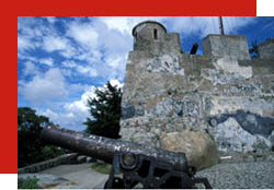 Monte Fort, built in 1617-26, occupies a hilltop to the east of the ruins of St. Paul's. It was constructed by the Jesuits as part of a complex which also included the college and church of St. Paul's. The canons were used only once, when the Dutch invaded Macau in 1622. This was also the first residence of the governors of Macau. Over the following decades trees grew from the platform of the fort, which was transformed into a public park where residents and visitors came to enjoy the views. The only building was an office of the Meteorological Department until 1998 when the three-level Macau Museum, focusing on the history of Macau, was built into the fortress hill. Monte Fort, built in 1617-26, occupies a hilltop to the east of the ruins of St. Paul's. It was constructed by the Jesuits as part of a complex which also included the college and church of St. Paul's. The canons were used only once, when the Dutch invaded Macau in 1622. This was also the first residence of the governors of Macau. Over the following decades trees grew from the platform of the fort, which was transformed into a public park where residents and visitors came to enjoy the views. The only building was an office of the Meteorological Department until 1998 when the three-level Macau Museum, focusing on the history of Macau, was built into the fortress hill.
|
| Mong-Há Fort |
|
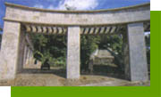 Mong Há Fort, situated on Mong Há Hill at the northern end of Macau, is a newer fortress, built in anticipation of a Chinese invasion following the Anglo-Chinese War in 1841. It was completed in 1866 and was in active service until the 1960's, when it was abandoned. Today the area has been turned into a park with flowerbeds, grassy slopes and walkways surrounding the old fortress walls. It provides a quiet refuge for people living in the nearby neighborhoods, and good views of the north end of the city. Mong Há Fort, situated on Mong Há Hill at the northern end of Macau, is a newer fortress, built in anticipation of a Chinese invasion following the Anglo-Chinese War in 1841. It was completed in 1866 and was in active service until the 1960's, when it was abandoned. Today the area has been turned into a park with flowerbeds, grassy slopes and walkways surrounding the old fortress walls. It provides a quiet refuge for people living in the nearby neighborhoods, and good views of the north end of the city.
|
| St. Francisco Barracks |
|
 Built 1629 on the site of a battery which sank one of the warships 'The Golias' of the Dutch invaders, the original fortress of S. Francisco stood at the end of old Praia Grande, facing the Taipa channel. Its armaments included a culverin, which could fire 35-pound iron shots a distance of one and a half miles (the width of the channel). Little more is known of the original fort or the convent of S. Francisco, which was attached to it. Built 1629 on the site of a battery which sank one of the warships 'The Golias' of the Dutch invaders, the original fortress of S. Francisco stood at the end of old Praia Grande, facing the Taipa channel. Its armaments included a culverin, which could fire 35-pound iron shots a distance of one and a half miles (the width of the channel). Little more is known of the original fort or the convent of S. Francisco, which was attached to it.
Both fort and convent were demolished to make way for new barracks in 1864, to house the Battalion of the First Line, brought in as defence against a Chinese attack which never came. The barracks survive today as headquarters for the Security Forces and sections of the Police Force. They present an attractive, colonial facade of pink-washed stone with white trim. Inside are offices and meeting rooms around a flag-stoned courtyard, in the spacious lobby are display cases filled with old prints and pictures of the previous fort and convent, a collection of old weapons and other.
None of Macau's other fortresses has survived, hut some reminders can he seen. The TAIPA FORT was rebuilt and is now used as a police station. The BOMPARTO FORT once stood on the praia and its ruins were used as foundations for the Bela Vista Hotel. Two of the old forts are recalled in very different way: the Penha Church now stands on the site of PENHA FORT, while the site of the DONA MARIA FORT marks a famous bend in the Guia Circuit of the Macau Grand Prix. As for the old city walls, all that remains are small sections behind the Bela Vista and on S. Januario Hill. |
| Guia Fort |
|
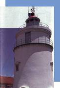 Our Lady of Guia chapel is closed for maintenance starting from 17th November 2003. Our Lady of Guia chapel is closed for maintenance starting from 17th November 2003.
Guia Fort, built in 1637-38, occupies the top of Guia Hill, the highest point in Macau. It was designed to defend Macau from attacks from the sea, but because of its position overlooking the entire city, its chief value has been as an observation post. It originally contained barracks, a water cistern, ammunition and equipment stores, the commander's house, and a chapel dedicated to Our Lady of Guia. Today the Fort's most prominent feature is the lighthouse, built in 1865 and the oldest on the China coast. It is 91 metres high and has a light which can be seen for around 20 miles in clear weather. Near the lighthouse is the chapel which contains an image of the Virgin Mary, a few antique pictures, and vestiges of paintings that date back to the construction of the chapel in 1626. Also nearby is a post where signals are hoisted to warn of an approaching typhoon. In earlier times storm warnings were announced from the bell-tower of the chapel. |
| Barra Fort |
|
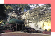 (Fortress of S. Tiago da Barra) (Fortress of S. Tiago da Barra)
Completed in 1629 on the site of an older cannon battery, Barra fort successfully protected the bar at the entrance to the Inner Harbour against the Dutch in 1622. Such credit was given to the fort, that between the 17th and 18th centuries, the commander of the fort was chosen directly by the king of Portugal and was not under the orders of the Macau governor or the captain general. The fort was described as a small town, built into the hills on the tip of the peninsula. The 30-feet chunambo walls, rising from stone foundations, were 19 feet thick at the base and 11 feet at the top. The main platform was 375' by 1.38' and supported 12 cannons of 24-pound calibre and four 50 pounders, a water cistern with 3,000-ton capacity and quarters for the commander and 60 soldiers. Higher up the hill was a guardhouse and six 24-pound cannons, while at ground level were stores for ammunitions and supplies, as well as a large house.
In 1740 a chapel was built in the fort, dedicated to St. James (S. Tiago), patron saint of the military. Legend has it that the saint's statue would patrol the fort at night and have mud on his boots in the morning, so a soldier was detailed to clean them. On one occasion it's said the soldier failed to do so and was hit on the head by St. James' sword.
After 1622 the fort's cannons were never needed, until World War 2 when they were sold for rice to feed refugees from Hong Kong and China. Over the years the fort was gradually demolished to make room for roads and by 1976 it was abandoned by the Marine Police. The Macau Government Tourist Office decided to convert the ruins into a Portuguese inn, which today is one of the city's great attractions. To discover how the architect used the original walls, made the cistern into a fountain, incorporated century-old trees into the design and restored the chapel, visitors are welcome any time at the Pousada de Sao Tiago. |

|